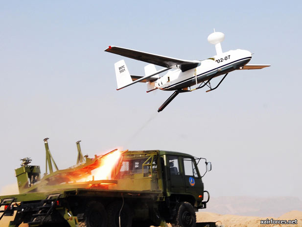
First for China as Military UAV Flies Mapping Mission

Drone Completes Military Mapping Mission in NW China.
An unmanned Chinese military drone recently completed its first digital mapping mission near north China's Helan mountain, capturing high-definition imaging data during more than five consecutive hours of aerial photography.
Conducted by the Lanzhou Military Area Command of the Chinese People's Liberation Army (PLA), the mission marked the first time for such type of unmanned drone to be used for military mapping purposes, military sources said Wednesday.
The success of the mission marks the Chinese military's creation of a drone-based emergency mapping support mechanism in north China, said Zhang Zhiyuan, the mission's field commander.
Source: Xinhua; YINCHUAN, China - April 19, 2012
Photo: Launch of a Chinese military UAV which carried out the Chinese military’s first digital mapping mission flown by a drone. (Xinhua Photo)
(20.04.2012)
|